
Maps of Sauk County

Where?
February 16, 2023,
When? 7pm
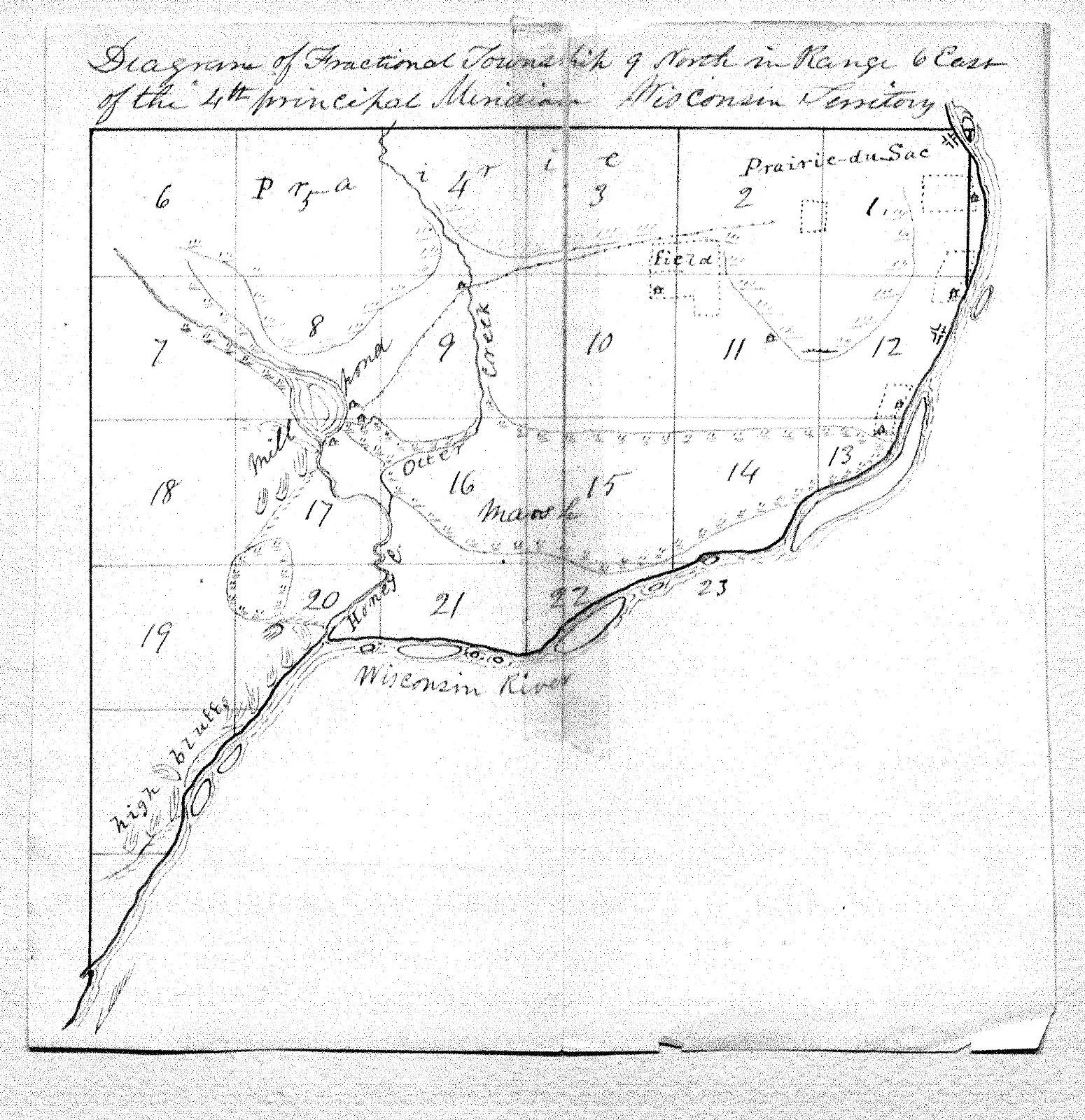
Maps with details of the Sauk County area date all the way back to 1673 when Father Marquette and Louis Joliet were the first Europeans to explore the full extent of the Fox and Wisconsin Rivers and make their way down the Mississippi River. Over the next 170 years maps of the Sauk County area became increasingly more detailed as other explorers came through the area. Jonathan Carver’s map from 1766 shows the location of the Sauk village as well as one of the first depictions of what is now the Baraboo River. It wasn’t until the 1840s however that fully detailed maps of Sauk County would be produced.
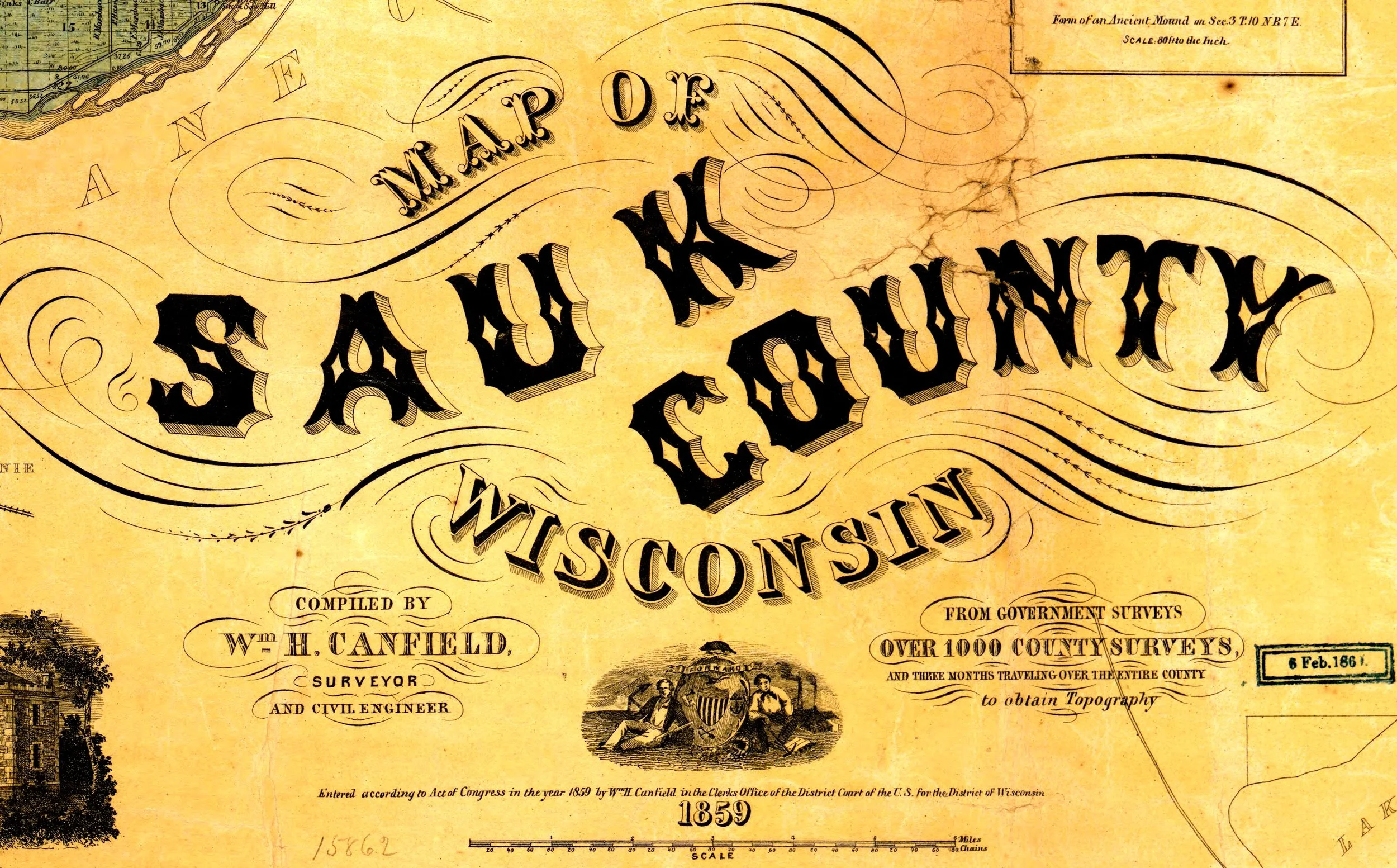
Maps of the area were commissioned by the federal government as the land was divided into a grid system to make it easier to sell. Early sketch maps by federal surveyors show interesting things like ancient trails, geological features and even the locations of early Euro-American settlements. The first map with landowners listed on it was published in 1859 by William H. Canfield. Plat maps started being produced in the last quarter of the 19th century and continue to be produced to present day.
A presentation on Maps of Sauk County will be held on Thursday, February 9 at 7 pm at the History Center and online one week later on February 16 at 7 pm (registration required).