
Video: Canfield’s Map
Canfield’s Maps Quiz
Students take this quiz individually if they are accessing the quiz from the student page on their own computer. Students must report their scores.
Discovering History: Using Maps Student Book
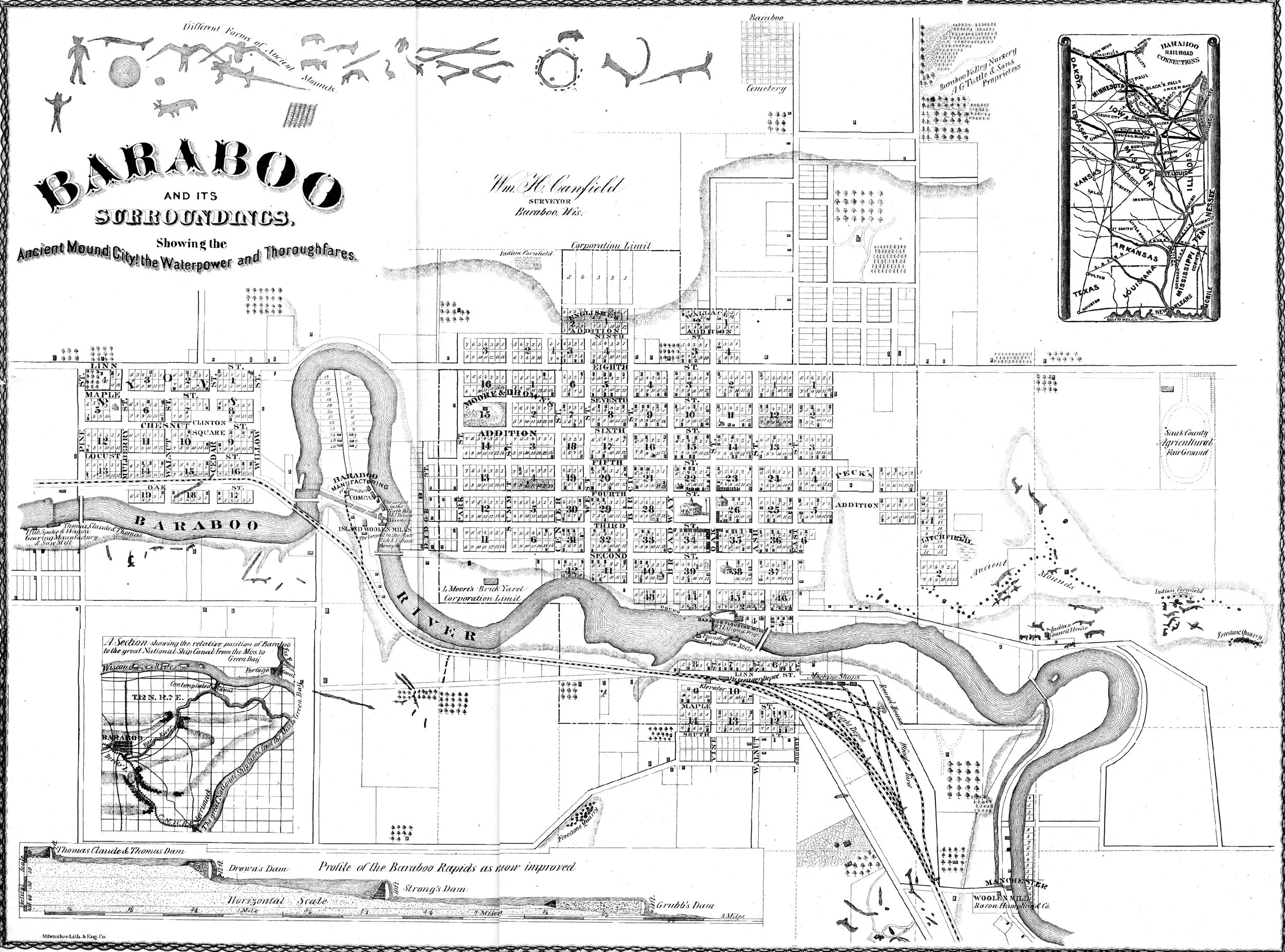
Handout - Canfield’s Map
Instructional Strategies - Using Maps
In Using Maps students are introduced to the highly detailed map William Canfield drew of Baraboo in 1872. They deepen their map reading skills by learning about map scale and the use of the legend. They also compare Canfield's historic map with modern maps, including satellite images. Students find details in the map and determine which are from today and which were included in Mr. Canfield's map.
Wisconsin Social Studies Standards Alignment
Learning Priority: (Inq2.a) Gather diverse sources (electronic, digital, print, and other mass media) applicable to the inquiry
3-5: Gather a variety of resources into categories to guide the inquiry.
Learning Priority: (Geog1.b) Spatial thinking (map interpretation)
3-5: Identify purposes of and differences among maps, globes, aerial photographs, charts, and satellite images.
Learning Priority: (Geog1.c) Mental mapping and maps from memory
3-5: Create and label a map (paper or digital) of the local community, state, tribal lands, and country, including both physical (e.g., oceans and continents) and human (e.g., roads, buildings) characteristics.
Learning Priority: (Geog2.a) Population and place
3-5: Compare and contrast types of communities (i.e., rural, suburban, urban, or tribal), and different types of places on Earth (e.g., community, state, region, country or nation).